De Soto, Kansas | |
|---|---|
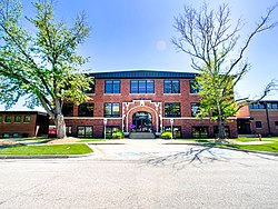
 De Soto City Hall (2022) | |
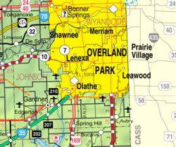
 Location within Johnson County and Kansas | |
 | |
| Coordinates: 38°58′07″N 94°57′18″W / 38.96861°N 94.95500°W[1] | |
| Country | United States |
| State | Kansas |
| Counties | Johnson, Leavenworth |
| Townships | Lexington, Sherman |
| Founded | 1828 |
| Platted | 1857 |
| Incorporated | October 1, 1897 |
| Named for | Hernando de Soto |
| Government | |
| • Type | Mayor–Council |
| • Mayor | Rick Walker |
| Area | |
• Total | 11.28 sq mi (29.22 km2) |
| • Land | 11.15 sq mi (28.89 km2) |
| • Water | 0.13 sq mi (0.33 km2) |
| Elevation | 853 ft (260 m) |
| Population | |
• Total | 6,118 |
| • Density | 540/sq mi (210/km2) |
| Time zone | UTC-6 (CST) |
| • Summer (DST) | UTC-5 (CDT) |
| ZIP codes | 66018, 66019, 66025, 66061 |
| Area code | 913 |
| FIPS code | 20-17850 |
| GNIS ID | 485562[1] |
| Website | desotoks.us |
De Soto /dəˈsoʊtoʊ/ is a city along the Kansas River, in Johnson and Leavenworth counties in the U.S. state of Kansas,[1] and part of the Kansas City Metropolitan Area. As of the 2020 census, the population of the city was 6,118,[3] and the 2021 estimate is 6,380.[4]
- ^ a b c d U.S. Geological Survey Geographic Names Information System: De Soto, Kansas
- ^ "2019 U.S. Gazetteer Files". United States Census Bureau. Retrieved July 24, 2020.
- ^ a b "Profile of De Soto, Kansas in 2020". United States Census Bureau. Archived from the original on November 19, 2022. Retrieved November 19, 2022.
- ^ a b "QuickFacts; De Soto, Kansas; Population, Census, 2020 & 2010". United States Census Bureau. Archived from the original on August 28, 2021. Retrieved August 28, 2021.
