| Debin Дебин | |
|---|---|
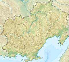
Mouth location in Magadan Oblast, Russia | |
| Location | |
| Federal subject | Magadan Oblast, Russia |
| Physical characteristics | |
| Source | |
| • location | Cherge Range |
| • coordinates | 63°18′38″N 148°25′54″E / 63.31056°N 148.43167°E |
| • elevation | 918 m (3,012 ft) |
| Mouth | Kolyma |
• location | Near Debin |
• coordinates | 62°18′06″N 150°47′16″E / 62.30167°N 150.78778°E |
• elevation | 317 m (1,040 ft) |
| Length | 248 km (154 mi) |
| Basin size | 5,530 km2 (2,140 sq mi) |
| Basin features | |
| Progression | Kolyma→ East Siberian Sea |
The Debin (Russian: Дебин) is a river in the Yagodninsky district of Magadan Oblast, Russia. It is a left hand tributary of the Kolyma. Its length is 248 kilometres (154 mi), counting the length of the Archagyl stream at its head, and it has a drainage basin of 5,530 square kilometres (2,140 sq mi).[1][2]
Yagodnoye village is located on the left bank of the Debin; the R504 Kolyma Highway crosses the river in its middle course and runs on the northern side of the river, roughly parallel to its lower course until it bends northwards near Debin.[3]
The name of the river is based on the Yakut word "daebin" (дьэбин), meaning "rust".[4]
- ^ Russian State Water Register - Ручьи Дебин (в верховье руч. Арчагыл)
- ^ Water of Russia - Kolyma
- ^ Google Maps
- ^ Leontyev V.V. , Novikova K.A. Toponymic Dictionary of the North-East of the USSR / Scientific ed. G. A. Menovschikov ; FEB AN USSR . North-East complex. Research institute for Archeology, History and Ethnography. - Magadan: Magad. Prince Publishing House , 1989 . P. 130 . - ISBN 5-7581-0044-7
