This article needs additional citations for verification. (August 2017) |
Dehiwala-Mount Lavinia
දෙහිවල-ගල්කිස්ස தெஹிவளை-கல்கிசை | |
|---|---|
| Colombo Metropolitan Region | |
Dehiwala Skyline and Beaches of Mount Lavinia | |
| Motto(s): Think differently and hope for the best! | |
| Coordinates: 6°52′23″N 79°52′33″E / 6.87306°N 79.87583°E | |
| Country | Sri Lanka |
| Province | |
| District | Colombo District |
| Government | |
| • Municipal Council | Dehiwala-Mount Lavinia Municipal Council |
| • Headquarters | DMMC – Dehiwala |
| • Mayor | Stanley Dias (SLPP) |
| Area | |
• Total | 21.09 km2 (8.142895 sq mi) |
| Elevation | 1 m (3 ft) |
| Population (2012 [1]) | |
• Total | 245,974 |
| • Density | 11,663/km2 (30,210/sq mi) |
| Time zone | UTC+5:30 (SLST) |
| Postal code | 10350 (Dehiwala) / 10370 (Mt Lavinia) |
| Area code | 011 |
| Website | dmmc |
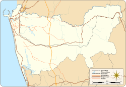
Dehiwala-Mount Lavinia (Sinhala: දෙහිවල-ගල්කිස්ස, romanized: Dehivala-Galkissa; Tamil: தெஹிவளை-கல்கிசை, romanized: Tehivaḷai-Kalkicai), population 245,974 (2012),[2] is a large municipality in Sri Lanka, covering 2,109 ha (5,210 acres). It lies south of the Colombo Municipal Council area and is separated from it by the Dehiwala canal which forms the northern boundary of DMMC. Its southern limits lie in Borupana Road and the eastern boundary is Weras Ganga with its canal system and it includes some areas to its east (Pepiliyana, Gangodawila and Kohuwala).[3] This town has experienced extensive population growth and rapid industrialisation and urbanisation in recent years. It is home to Sri Lanka's National Zoological Gardens, which remains one of Asia's largest. Colombo South Teaching Hospital, Kalubowila and Colombo Airport, Ratmalana are some important landmarks in this area. Dehiwela-Mount Lavinia and Sri Jayawardenapura Kotte being two large suburban centres of the city of Colombo function together as one large urban agglomeration in the Region (Western Province). The overspill from the City in residential and commercial uses of land has rapidly urbanised these suburban centres. Dehiwela-Mount Lavinia and Sri Jayawardenpaura along with Colombo Municipal Council form the most urbanised part of the core area of the Colombo Metropolitan Region. Dehiwala and Mount Lavinia lie along the Galle Road artery, which runs along the coast to the south of the country.[4]
- ^ "A6 : Census of Population and Housing, 2012".
- ^ "Census of Population and Housing – 2012". www.statistics.gov.lk. Retrieved 2017-06-24.
- ^ ICTA. "Colombo Divisional Secretariat – Overview". www.dehiwala.ds.gov.lk. Archived from the original on 2017-12-25. Retrieved 2017-06-24.
- ^ "City Profile – Dehiwala Mount Lavinia Municipal Council" (PDF). Archived from the original (PDF) on 2017-10-31. Retrieved 2017-06-24.


