Del Sol-Loma Linda, Texas | |
|---|---|
former CDP | |
 | |
| Coordinates: 28°0′55″N 97°30′47″W / 28.01528°N 97.51306°W | |
| Country | United States |
| State | Texas |
| County | San Patricio |
| Area | |
| • Total | 2.8 sq mi (7.2 km2) |
| • Land | 2.8 sq mi (7.2 km2) |
| • Water | 0.0 sq mi (0.0 km2) |
| Population (2000) | |
| • Total | 726 |
| • Density | 262.3/sq mi (101.3/km2) |
| Time zone | UTC-6 (Central (CST)) |
| • Summer (DST) | UTC-5 (CDT) |
| FIPS code | 48-19810[1] |
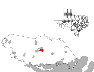
Del Sol-Loma Linda is a former census-designated place (CDP) in San Patricio County, Texas, United States. The population was 726 at the 2000 U.S. Census.
The Del Sol-Loma Linda CDP, active in the 2000 census,[2] was deleted in the 2010 census and parts taken to form three new CDPs: Del Sol,[3] La Paloma Addition,[4] and Loma Linda CDPs.[5][6]
- ^ "U.S. Census website". United States Census Bureau. Retrieved January 31, 2008.
- ^ "CENSUS 2000 BLOCK MAP: DEL SOL−LOMA LINDA CDP" (PDF). U.S. Census Bureau. Retrieved February 16, 2024.
- ^ "2010 CENSUS - CENSUS BLOCK MAP: Del Sol CDP, TX" (PDF). U.S. Census Bureau. Retrieved February 16, 2024.
- ^ "2010 CENSUS - CENSUS BLOCK MAP: La Paloma Addition CDP, TX" (PDF). U.S. Census Bureau. Retrieved February 16, 2024.
- ^ "2010 CENSUS - CENSUS BLOCK MAP: Loma Linda CDP, TX" (PDF). U.S. Census Bureau. Retrieved February 16, 2024.
- ^ "Population and Housing Unit Counts, 2010 Census of Population and Housing" (PDF). Texas: 2010.