Demarest, New Jersey | |
|---|---|
 | |
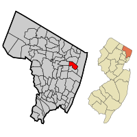
 Location of Demarest in Bergen County highlighted in red (left). Inset map: Location of Bergen County in New Jersey highlighted in orange (right). | |
 Census Bureau map of Demarest, New Jersey | |
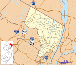
Location in Bergen County Location in New Jersey | |
| Coordinates: 40°57′12″N 73°57′23″W / 40.953365°N 73.956348°W[1][2] | |
| Country | |
| State | |
| County | Bergen |
| Incorporated | April 8, 1903 |
| Named for | Ralph S. Demarest |
| Government | |
| • Type | Borough |
| • Body | Borough Council |
| • Mayor | Brian K. Bernstein (D, term ends December 31, 2026)[3][4] |
| • Administrator | Julie Falkenstern[5] |
| • Municipal clerk | Julie Falkenstern (acting)[6] |
| Area | |
• Total | 2.08 sq mi (5.38 km2) |
| • Land | 2.07 sq mi (5.37 km2) |
| • Water | 0.01 sq mi (0.02 km2) 0.34% |
| • Rank | 405th of 565 in state 46th of 70 in county[1] |
| Elevation | 52 ft (16 m) |
| Population | |
• Total | 4,981 |
• Estimate (2023)[11] | 4,846 |
| • Rank | 375th of 565 in state 60th of 70 in county[12] |
| • Density | 2,403.4/sq mi (928.0/km2) |
| • Rank | 259th of 565 in state 54th of 70 in county[12] |
| Time zone | UTC−05:00 (Eastern (EST)) |
| • Summer (DST) | UTC−04:00 (Eastern (EDT)) |
| ZIP Code | |
| Area code(s) | 201 exchanges: 750, 767, 768, 784[15] |
| FIPS code | 3400317530[1][16][17] |
| GNIS feature ID | 0885195[1][18] |
| Website | demarestnj |
Demarest is a borough in Bergen County, in the U.S. state of New Jersey. As of the 2020 United States census, the borough's population was 4,981,[10] an increase of 100 (+2.0%) from the 2010 census count of 4,881,[19][20] which in turn reflected an increase of 36 (+0.7%) from the 4,845 counted in the 2000 census.[21] Located in the northeastern corner of New Jersey and its Gateway Region, Demarest is part of the New York City Metropolitan Area.
Demarest was formed by an act of the New Jersey Legislature on April 8, 1903, from portions of Harrington Township and Palisades Township.[22][23] The borough was named for the Demarest family[24] and for the Demarest train station, which had in turn been named for Ralph S. Demarest, who was a director of the Northern Railroad of New Jersey that built the station and represented the area in both the New Jersey General Assembly and the New Jersey Senate in the mid-19th century.[25][26]
- ^ a b c d 2019 Census Gazetteer Files: New Jersey Places, United States Census Bureau. Accessed July 1, 2020.
- ^ U.S. Gazetteer Files for 2000, 2010 and 2012-2016, United States Census Bureau. Accessed September 4, 2017.
- ^ Cite error: The named reference
Committeewas invoked but never defined (see the help page). - ^ 2023 New Jersey Mayors Directory, New Jersey Department of Community Affairs, updated February 8, 2023. Accessed February 10, 2023.
- ^ Borough Administrator, Borough of Demarest. Accessed April 21, 2024.
- ^ Borough Clerk, Borough of Demarest. Accessed April 21, 2024.
- ^ Cite error: The named reference
DataBookwas invoked but never defined (see the help page). - ^ "ArcGIS REST Services Directory". United States Census Bureau. Retrieved October 11, 2022.
- ^ U.S. Geological Survey Geographic Names Information System: Borough of Demarest, Geographic Names Information System. Accessed March 5, 2013.
- ^ a b Cite error: The named reference
LWD2020was invoked but never defined (see the help page). - ^ Cite error: The named reference
PopEstwas invoked but never defined (see the help page). - ^ a b Population Density by County and Municipality: New Jersey, 2020 and 2021, New Jersey Department of Labor and Workforce Development. Accessed March 1, 2023.
- ^ Look Up a ZIP Code for Demarest, NJ, United States Postal Service. Accessed September 12, 2011.
- ^ ZIP Codes, State of New Jersey. Accessed October 8, 2013.
- ^ Area Code Lookup - NPA NXX for Demarest, NJ, Area-Codes.com. Accessed October 8, 2013.
- ^ U.S. Census website, United States Census Bureau. Accessed September 4, 2014.
- ^ Geographic Codes Lookup for New Jersey, Missouri Census Data Center. Accessed April 1, 2022.
- ^ US Board on Geographic Names, United States Geological Survey. Accessed September 4, 2014.
- ^ Cite error: The named reference
Census2010was invoked but never defined (see the help page). - ^ Cite error: The named reference
LWD2010was invoked but never defined (see the help page). - ^ Table 7. Population for the Counties and Municipalities in New Jersey: 1990, 2000 and 2010, New Jersey Department of Labor and Workforce Development, February 2011. Accessed May 1, 2023.
- ^ Snyder, John P. The Story of New Jersey's Civil Boundaries: 1606-1968, Bureau of Geology and Topography; Trenton, New Jersey; 1969. p. 76. Accessed May 17, 2012.
- ^ History of Bergen County Vol. 1, p. 349 shows date of Demarest's formation as April 13, 1903.
- ^ Hutchinson, Viola L. The Origin of New Jersey Place Names, New Jersey Public Library Commission, May 1945. Accessed November 10, 2015.
- ^ Cheslow, Jerry. "If You're Thinking of Living In / Demarest, N.J.; Small Town, Large Sense of History", The New York Times, April 4, 1999. Accessed December 4, 2013. "The borough is named for State Senator Ralph S. Demarest -- a direct descendant of David Desmarets -- who, as a director of the New Jersey Line Railroad (later taken over by the Erie Railroad), brought trains to town in 1859. He lived directly across from the train station, built in 1872 from locally quarried freestone."
- ^ Hutchinson, Viola L. The Origin of New Jersey Place Names, New Jersey Public Library Commission, May 1945. Accessed August 28, 2015.


