Denton County | |
|---|---|
County | |
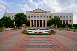
 The Denton County Courts Building, built 1998 | |
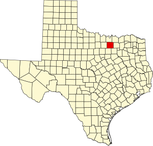
 Location within the U.S. state of Texas | |
 Texas's location within the U.S. | |
| Coordinates: 33°12′N 97°07′W / 33.2°N 97.12°W | |
| Country | |
| State | |
| Founded | April 11, 1846 |
| Named for | John B. Denton |
| Seat | Denton |
| Largest city | Denton |
| Area | |
• Total | 953 sq mi (2,470 km2) |
| • Land | 878 sq mi (2,270 km2) |
| • Water | 75 sq mi (190 km2) 7.8% |
| Population (2020) | |
• Total | 906,422 |
• Estimate (2023) | 1,006,492 |
| • Density | 950/sq mi (370/km2) |
| Time zone | UTC−6 (Central) |
| • Summer (DST) | UTC−5 (CDT) |
| Congressional districts | 4th, 13th, 26th, 32nd |
| Website | dentoncounty |
Denton County is located in the U.S. state of Texas. As of the 2020 census, its population was 906,422, making it the seventh-most populous county in Texas.[1] The county seat is Denton.[2] The county, which was named for John B. Denton, was established in 1846. Denton County constitutes part of the Dallas–Fort Worth metroplex. In 2007, it was one of the fastest-growing counties in the United States.[3]
- ^ "U.S. Census Bureau QuickFacts: Denton County, Texas". US Census Bureau. Retrieved January 31, 2022.
- ^ "Find a County". National Association of Counties. Retrieved June 7, 2011.
- ^ Census 2007.
