Des Peres, Missouri | |
|---|---|
 Des Peres City Hall predates the city's incorporation. It was originally built by the neighboring Lutheran Church as an orphanage. | |
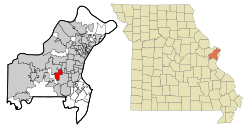
 Location of Des Peres, Missouri | |
| Coordinates: 38°35′51″N 90°26′53″W / 38.59750°N 90.44806°W | |
| Country | United States |
| State | Missouri |
| County | St. Louis |
| Area | |
• Total | 4.32 sq mi (11.20 km2) |
| • Land | 4.32 sq mi (11.19 km2) |
| • Water | 0.01 sq mi (0.01 km2) |
| Elevation | 617 ft (188 m) |
| Population (2020) | |
• Total | 9,193 |
| • Density | 2,128.50/sq mi (821.73/km2) |
| Time zone | UTC-6 (Central (CST)) |
| • Summer (DST) | UTC-5 (CDT) |
| FIPS code | 29-19270[3] |
| GNIS feature ID | 2394523[2] |
| Website | www |
Des Peres (English: /dʌˈpɛər/) is a city in west St. Louis County, Missouri, United States. The population was 8,373 at the 2010 census.[4]
- ^ "ArcGIS REST Services Directory". United States Census Bureau. Retrieved August 28, 2022.
- ^ a b U.S. Geological Survey Geographic Names Information System: Des Peres, Missouri
- ^ "U.S. Census website". United States Census Bureau. Retrieved January 31, 2008.
- ^ "Race, Hispanic or Latino, Age, and Housing Occupancy: 2010 Census Redistricting Data (Public Law 94-171) Summary File (QT-PL), Des Peres city, Missouri". United States Census Bureau. Retrieved October 21, 2011.
