 | |
| Author | Pausanias |
|---|---|
| Original title | Ἑλλάδος Περιήγησις |
| Language | Greek |
| Subject | geography |
| Published | the second century AD |
| Publication place | Ancient Greece |
| Text | Description of Greece at Wikisource |
Description of Greece (Ancient Greek: Ἑλλάδος Περιήγησις, romanized: Helládos Periḗgēsis) is the only surviving work by the ancient "geographer" or tourist Pausanias (c. 110 – c. 180).[1]

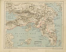
Pausanias' Description of Greece comprises ten books, each of them dedicated to some part of mainland Greece. He is essentially describing his own travels, and large parts of Greece are not covered, including the islands. His tour begins in Attica (Ἀττικά) and continues with Athens, including its suburbs or demes. Then the work goes with Corinthia (Κορινθιακά), Laconia (Λακωνικά), Messenia (Μεσσηνιακά), Elis (Ἠλιακά), Achaea (Ἀχαϊκά), Arcadia (Ἀρκαδικά), Boeotia (Βοιωτικά), Phocis (Φωκικά), and Ozolian Locris (Λοκρῶν Ὀζόλων).[2]
The work is rather erratic on described topography; its main interest is the cultural geography of ancient Greece, especially its religious sites, in which Pausanias not only described architectural and artistic objects, but also reviewed the historical and mythological underpinnings of the culture that created them.[3] Recent decades, during which archaeology has confirmed various of his descriptions, have increased his credibility as a witness among scholars. In the 19th century his accounts were often regarded as unreliable.
We know nothing about Pausanias except what can be deduced from his book. There are no ancient mentions of either until the 6th century AD, and the book seems to have survived to the Middle Ages in a single manuscript, itself now lost. However, it attracted great interest in the Renaissance, and was copied in manuscript several times, before being first printed in 1516.
- ^ "Pausania detto il Periegeta". Summa Gallicana. Retrieved 5 April 2023.
- ^ Pausanias. Description of Greece. Translated by Jones W H S. 5. Vol. 1-5. Cambridge, Massachusetts: Harvard University Press, 1918.[page needed][non-primary source needed]
- ^ Habicht, Christian (April 1984). "Pausanias and the Evidence of Inscriptions". Classical Antiquity. 3 (1): 40–56. doi:10.2307/25010806. JSTOR 25010806.