Destrehan | |
|---|---|
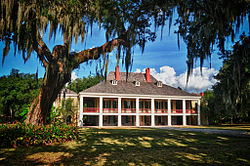
 Destrehan Plantation, est. 1780–1790 | |
| Coordinates: 29°57′44″N 90°22′09″W / 29.96222°N 90.36917°W | |
| Country | United States |
| State | Louisiana |
| Parish | St. Charles |
| Named for | Jean Noël Destréhan |
| Area | |
• Total | 6.98 sq mi (18.07 km2) |
| • Land | 5.97 sq mi (15.46 km2) |
| • Water | 1.01 sq mi (2.61 km2) |
| Elevation | 10 ft (3 m) |
| Population (2020) | |
• Total | 11,340 |
| • Density | 1,900.45/sq mi (733.71/km2) |
| Time zone | UTC-6 (CST) |
| • Summer (DST) | UTC-5 (CDT) |
| Area code | 985 |
| FIPS code | 22-20820 |
Destrehan is an unincorporated community and census-designated place (CDP) in St. Charles Parish, Louisiana, United States. At the 2020 census, its population was 11,340.[2] It is located on the east bank of the Mississippi River. Destrehan is part of the New Orleans—Metairie—Kenner metropolitan statistical area.
- ^ "2020 U.S. Gazetteer Files". United States Census Bureau. Retrieved March 20, 2022.
- ^ "2020 Race and Population Totals". United States Census Bureau. Archived from the original on October 25, 2021. Retrieved October 25, 2021.
