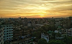
Dhaka District
ঢাকা জেলা Dhaka Zilla | |
|---|---|
 Location of Dhaka District within Bangladesh | |
 Expandable map of Dhaka District | |
| Coordinates: 23°47′N 90°18′E / 23.79°N 90.30°E | |
| Country | |
| Division | Dhaka |
| Headquarters | Dhaka |
| Government | |
| • Deputy Commissioner | Md. Mominur Rahman[1] |
| • District Council Chairman | Md. Mahbubur Rahman[2] |
| • Chief Executive Officer | Md. Mamunur Rashid |
| Area | |
• District | 1,463.6 km2 (565.1 sq mi) |
| Population | |
• District | 14,734,701 |
| • Rank | 1st in Bangladesh |
| • Density | 10,000/km2 (26,000/sq mi) |
| • Urban | 11,237,217 |
| • Rural | 3,497,484 |
| Demonym(s) | Dhakai, Dhakaiya |
| GDP (2015 US dollar) | |
| • Total | $50.1 billion (2023)[4] |
| • Per capita | $3,600 (2023) |
| GDP (PPP, 2015 international dollar) | |
| • Total | $167.2 billion (2023) |
| • Per capita | $12,100 (2023) |
| Postal code | 1000 |
| Area code | 02 |
| ISO 3166 code | BD-13 |
| HDI (2022) | high · 1st of 20 |
| Website | www |
Dhaka District (Bengali: ঢাকা জেলা, romanized: Ḍhākā jēlā) is a district in central Bangladesh,[6] and is the densest district in the nation. It is a part of the Dhaka Division. Dhaka, the capital of Bangladesh, and rests on the eastern banks of the Buriganga River which flows from the Turag to the southern part of the district. The former Dhaka city corporation occupied only about a fifth of the area of Dhaka district until 2011 where the municipal corporation was fractionated and rearranged in North and South corporations due to being the economic, political and cultural centre of the district and also the country. Dhaka District consists of Dhaka, Keraniganj, Nawabganj, Dohar, Savar and Dhamrai upazila. Dhaka District is an administrative entity, and like many other cities, it does not cover the modern conurbation which is Greater Dhaka, which has spilled into neighbouring districts, nor does the conurbation cover the whole district, as there are rural areas within the district.
- ^ Cite error: The named reference
dclistwas invoked but never defined (see the help page). - ^ zpdhaka.org
- ^ Cite error: The named reference
2022censuswas invoked but never defined (see the help page). - ^ "TelluBase—Dhaka Fact Sheet (Tellusant Public Service Series)" (PDF). Retrieved 11 January 2024.
- ^ https://globaldatalab.org/shdi/table/shdi/BGD/?levels=1+4&years=2022&interpolation=0&extrapolation=0
- ^ Molla, Md Tuhin (2012). "Dhaka District". In Islam, Sirajul; Jamal, Ahmed A. (eds.). Banglapedia: National Encyclopedia of Bangladesh (Second ed.). Asiatic Society of Bangladesh. Archived from the original on 15 May 2019. Retrieved 30 June 2015.


