Diamir District
ضلع دیامر | |
|---|---|
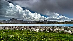
 Shanrgah Lake in Shatti Choi Valley | |
 | |
| Country | |
| Territory | |
| Division | Diamer Division |
| Headquarters | Chilas |
| Government | |
| • Type | District Administration |
| • Deputy Commissioner | N/A |
| • District Police Officer | N/A |
| • District Health Officer | N/A |
| Area | |
• Total | 10,936 km2 (4,222 sq mi) |
| Population (2013) | |
• Total | 214,000 |
| Number of tehsils | 2 |
Diamer District (Urdu: ضلع دیامر), also spelled Diamir District,[1][2]) is a district in the Gilgit-Baltistan region administered by Pakistan. The headquarters of the district is the town of Chilas. The district is bounded on the north by the Tangir and the Gilgit districts, on the east by the Astore District, on the south by the Mansehra district of Pakistan's Khyber Pakhtunkhwa Province and the Neelum District of Pakistan controlled Kashmir, and on the west by the Upper Kohistan District of Khyber Pakhtunkhwa Province. The Karakoram Highway passes through Diamer District.
- ^ Guide to Standard Floras of the World: An Annotated, Geographically Arranged Systematic Bibliography of the Principal Floras, Enumerations, Checklists and Chorological Atlases of Different Areas 2, revised: David G. Frodin Published by Cambridge University Press, 2001, Page R79
- ^ Islam, Women, and Violence in Kashmir: Between India and Pakistan: Nyla Ali Khan Published by Palgrave Macmillan, 2010, Page 9