Djendel
Arabic: جندل Berber: ⴵⴻⵏⴷⴻⵍ | |
|---|---|
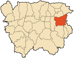
 The boundary of Djendel | |
 Djendel's location within Aïn Defla Province | |
Djendel's location within Algeria | |
| Coordinates: 36°13′07″N 2°24′32″E / 36.21861°N 2.40889°E | |
| Country | Algeria |
| Province | Aïn Defla |
| Area | |
| • Total | 251.0 km2 (96.91 sq mi) |
| Population (2008) | |
| • Total | 30,170 |
| • Density | 120/km2 (300/sq mi) |
| Time zone | UTC+1 (West Africa Time) |
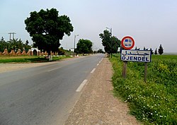
Djendel (formerly Lavigerie during the period of French colonization) is a commune in the Aïn Defla wilaya in northern Algeria, located 110 km southwest of Algiers, 40 km east of Aïn Defla, and 30 km southwest of Médéa.
