Doi Saket
ดอยสะเก็ด | |
|---|---|
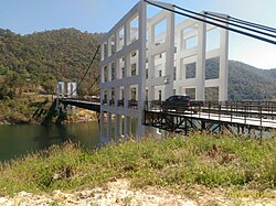
 A suspension bridge over the Mae Kuang Udom Thara Dam | |
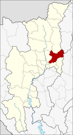
 District location in Chiang Mai province | |
| Coordinates: 18°52′13″N 99°8′12″E / 18.87028°N 99.13667°E | |
| Country | Thailand |
| Province | Chiang Mai |
| Seat | Doi Saket |
| Tambon | 14 |
| Muban | 110 |
| District established | 1902 |
| Area | |
• Total | 671.3 km2 (259.2 sq mi) |
| Population (2005) | |
• Total | 64,116 |
| • Density | 95.5/km2 (247/sq mi) |
| Time zone | UTC+7 (ICT) |
| Postal code | 50220 |
| Geocode | 5005 |


Doi Saket (Thai: ดอยสะเก็ด, pronounced [dɔ̄ːj sā.kèt]; Northern Thai: ![]() ดอยสะเก๋ด, pronounced [dɔ̄ːj sā.kět]) is a district (amphoe) in the eastern part of Chiang Mai province in northern Thailand. The district is predominantly a rural farming area, containing a mixture of rice fields on the valley floor to orchard and other farming on the hillsides. The village is known for its murals inside Wat Doi Saket.
ดอยสะเก๋ด, pronounced [dɔ̄ːj sā.kět]) is a district (amphoe) in the eastern part of Chiang Mai province in northern Thailand. The district is predominantly a rural farming area, containing a mixture of rice fields on the valley floor to orchard and other farming on the hillsides. The village is known for its murals inside Wat Doi Saket.