| Dojran Lake Дојранско Езеро Λίμνη Δοϊράνη | |
|---|---|
 | |
| Location | Region of Macedonia |
| Coordinates | 41°13′N 22°45′E / 41.217°N 22.750°E |
| Basin countries | Greece, North Macedonia |
| Max. length | 8.9 km (5.5 mi) |
| Max. width | 7.1 km (4.4 mi) |
| Surface area | 43.1 km2 (16.6 sq mi) |
| Max. depth | 10 m (33 ft) |
| Surface elevation | 148 m (486 ft) |
 | |
| Official name | Dojran Lake |
| Designated | 2 August 2007 |
| Reference no. | 1735[1] |
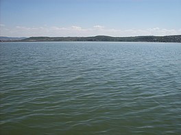
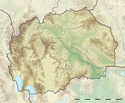
Doiran Lake (Macedonian: Дојранско Езеро, Dojransko Ezero; Greek: Λίμνη Δοϊράνη, Límni Dhoïráni), also spelled Dojran Lake[2] is a lake with an area of 43.1 km2 (16.6 sq mi)[3] shared between North Macedonia (27.3 km2, 10.5 sq mi) and Greece (15.8 km2, 6.1 sq mi).
To the west is the city of Nov Dojran (Нов Дојран), to the east the village of Mouries, to the north the mountain Belasica/Beles and to the south the Greek town of Doirani. The lake has a rounded shape, a maximum depth of 10 m (33 ft) and a north-to-south length of 8.9 km (5.5 mi) and is 7.1 km (4.4 mi) at its widest, making it the third largest lake partially in North Macedonia after Lake Ohrid and Lake Prespa.
- ^ "Dojran Lake". Ramsar Sites Information Service. Retrieved 25 April 2018.
- ^ "The Return of the Glorious Past - Lake Dojran". Archived from the original on 29 October 2016. Retrieved 28 October 2016.
- ^ "Dojran Lake". Retrieved 28 October 2016.
