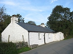
| Dolbenmaen | |
|---|---|
 Min y Ddol | |
Location within Gwynedd | |
| Area | 96.40 km2 (37.22 sq mi) |
| Population | 1,343 (2011) |
| • Density | 14/km2 (36/sq mi) |
| OS grid reference | SH506430 |
| Community |
|
| Principal area | |
| Preserved county | |
| Country | Wales |
| Sovereign state | United Kingdom |
| Post town | CRICCIETH |
| Postcode district | LL49 |
| Post town | PORTHMADOG |
| Postcode district | LL51 |
| Post town | GARNDOLBENMAEN |
| Postcode district | LL52 |
| Dialling code | 01766 |
| Police | North Wales |
| Fire | North Wales |
| Ambulance | Welsh |
| UK Parliament | |
| Senedd Cymru – Welsh Parliament | |
Dolbenmaen () is a village and community in the Welsh county of Gwynedd, located in Eifionydd, of which it was the administrative centre until 1239.[1] The community includes the villages of Bryncir (), Cenin, Garndolbenmaen, (the largest settlement) Golan, Llanfihangel-y-Pennant, Penmorfa (), Pentrefelin, Wern, Glan-dwyfach, and the hamlet of Prenteg. It has a population of 1,300,[2] increasing slightly to 1,343 at the 2011 Census.[3] The summit of Moel Hebog is shared between Beddgelert and Dolbenmaen. It is a sparsely populated area and covers nearly 100 square kilometres.[4]

A castle motte is located to the south of the village which is thought to have been the residence of Llywelyn the Great until the 1230s, when the court moved to a new castle at Criccieth. The castle guarded a ford on the Afon Dwyfor which may have been on the Pen Llystyn (Tremadog) to Segontium Roman road.[5] The parish church of St Mary's is a grade II* listed building.[6] South of Pentrefelin is St Cynhaearn's Church, Ynyscynhaearn.
- ^ Criccieth Visitors' Map and Brief History, 2002, Cymdeithas Hanes Eifionydd Archived 29 May 2014 at the Wayback Machine, Wales
- ^ Office for National Statistics : Census 2001 : Parish Headcounts : Gwynedd Archived 22 September 2010 at the Wayback Machine Retrieved 13 January 2010
- ^ "Community population 2011". Retrieved 15 May 2015.
- ^ "Custom report - Nomis - Official Labour Market Statistics".
- ^ "DOLBENMAEN CASTLE MOUND | Coflein". www.coflein.gov.uk. Retrieved 23 August 2018.
- ^ "Parish Church of St Mary, Dolbenmaen". British Listed Buildings. Retrieved 16 December 2013.
