Dolores Hidalgo | |
|---|---|
City and Municipality | |
 | |
| Coordinates: 21°9′5.7″N 100°56′12.8″W / 21.151583°N 100.936889°W | |
| Country | |
| State | Guanajuato |
| Established | September 16, 1810 |
| Government | |
| • Type | Municipality |
| • Municipality President | Adrian Hernández Alejandri |
| Area | |
| • City | 13.26 km2 (5.12 sq mi) |
| • Municipality | 1,656 km2 (639 sq mi) |
| Population (2020 census)[1] | |
| • City | 67,101 |
| • Density | 5,100/km2 (13,000/sq mi) |
| • Municipality | 163,038 |
| • Municipality density | 98/km2 (250/sq mi) |
| Time zone | Zona Centro |
| Postal Code | 37800–37849 |
| Area code | 02-8082722 |

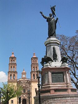
Dolores Hidalgo (Spanish: [doˈloɾes iˈðalɣo] ; in full, Dolores Hidalgo Cuna de la Independencia Nacional, English: Dolores Hidalgo Birthplace of [Mexican] National Independence) is the name of a city and the surrounding municipality in the north-central part of the Mexican state of Guanajuato.
It is located at 21°10′N 100°56′W / 21.17°N 100.93°W, at an elevation of about 1,980 meters (6,500 feet) above sea level. In the census of 2005 the city had a population of 54,843, while the municipality had 134,641 inhabitants. The city lies directly in the center of the municipality, which is 1,656 km2 (639 sq mi) in area and includes numerous small outlying communities, the largest of which is Río Laja with a population of 2,211 (2005 census).[1]
Dolores Hidalgo was named a Pueblo Mágico (Magic Town) in 2002
- ^ a b Citypopulation.de Population of Dolores Hidalgo Cuna de la Independencia National municipality with localities

