| Dolwyddelan | |
|---|---|
 View north over Dolwyddelan, with Moel Siabod behind | |
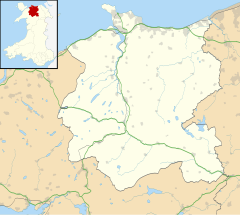
Location within Conwy | |
| Population | 454 [1][2] |
| OS grid reference | SH730511 |
| Community |
|
| Principal area | |
| Preserved county | |
| Country | Wales |
| Sovereign state | United Kingdom |
| Post town | DOLWYDDELAN |
| Postcode district | LL25 |
| Dialling code | 01690 |
| Police | North Wales |
| Fire | North Wales |
| Ambulance | Welsh |
| UK Parliament | |
| Senedd Cymru – Welsh Parliament | |
Dolwyddelan (English: /ˌdɒlwɪˈðɛlæn/ dol-with-EL-an; Welsh: [ˌdɔlwɪˈðɛlan]; ) is a village and community in Conwy County Borough, Wales. The community occupies most of the valley of the Afon Lledr, and contains the settlements of Dolwyddelan, Pentre Bont, Blaenau Dolwyddelan, and Pont-y-Pant. It lies within Snowdonia, and the surrounding hills are part of the Moelwynion range. The population of the community was recorded as 454 in the 2021 census, and in the 2011 census the proportion of Welsh speakers was recorded as 50.8%.[3][4]
Dolwyddelan was a centre within the Kingdom of Gwynedd in the twelfth and thirteenth centuries; it is likely that Prince Llywelyn the Great was born in Tomen Castell, west of the village, in c. 1173. Llywelyn built Dolwyddelan Castle some time between 1210 and 1240, although after its capture by Edward I of England in 1283, the military importance of the area declined. In 1488, the lease on the area was bought by Maredudd ab Ieuan, and it later became part of the large Gwydir Estate. In the nineteenth century slate was mined in the area.
- ^ Dolweddelan comprises output areas W00000641 and W00000642, the data for which can be downloaded from "Number of usual residents in households and communal establishments". Office for National Statistics. Retrieved 17 July 2023. Output areas can be found at "Census maps". Office for National Statistics. Retrieved 19 July 2023.
- ^ "Community population and percent of Welsh speakers 2011". Archived from the original on 22 May 2015. Retrieved 21 May 2015.
