Donegal Airport Aerfort Dhún na nGall | |||||||||||
|---|---|---|---|---|---|---|---|---|---|---|---|
 | |||||||||||
 | |||||||||||
| Summary | |||||||||||
| Airport type | Public | ||||||||||
| Operator | Airports Donegal | ||||||||||
| Serves | County Donegal | ||||||||||
| Location | Carrickfinn | ||||||||||
| Elevation AMSL | 30 ft / 9 m | ||||||||||
| Coordinates | 55°02′39″N 008°20′28″W / 55.04417°N 8.34111°W | ||||||||||
| Website | www.donegalairport.ie | ||||||||||
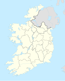
| Map | |||||||||||
| Runways | |||||||||||
| |||||||||||
| Statistics (2023) | |||||||||||
| |||||||||||
Donegal Airport (Irish: Aerfort Dhún na nGall) (IATA: CFN, ICAO: EIDL) is a regional airport in Ireland, serving County Donegal and the north-west. It is located on the coast, 2 NM (3.7 km; 2.3 mi)[1] south-west of Bunbeg in Carrickfinn, a townland in The Rosses, a district in north-west County Donegal. It is about a 15-minute drive from Dungloe and Gweedore and 45 minutes from Letterkenny. It was generally known until the 1990s, and is still popularly known within County Donegal, as Carrickfinn Airport, from which its airport code (CFN) is derived.
- ^ a b EIDL – DONEGAL (PDF). AIP and charts from the Irish Aviation Authority.
- ^ "Aviation Statistics 2016". Central Statistics Office. 18 April 2017. Archived from the original on 19 April 2017. Retrieved 18 April 2017.
