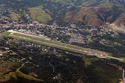
Dortheys Hiyo Eluay International Airport Bandar Udara Internasional Dortheys Hiyo Eluay | |||||||||||
|---|---|---|---|---|---|---|---|---|---|---|---|
 Aerial view of the airport | |||||||||||
| Summary | |||||||||||
| Airport type | Public | ||||||||||
| Owner | Government of Indonesia | ||||||||||
| Operator | Angkasa Pura I | ||||||||||
| Serves | Jayapura | ||||||||||
| Location | Jayapura Regency, Papua, Indonesia | ||||||||||
| Time zone | WIT (UTC+09:00) | ||||||||||
| Elevation AMSL | 289 ft / 88 m | ||||||||||
| Coordinates | 2°34′37″S 140°30′58″E / 2.57694°S 140.51611°E | ||||||||||
| Website | www | ||||||||||
| Maps | |||||||||||
 Western New Guinea region in Indonesia | |||||||||||
 | |||||||||||
| Runways | |||||||||||
| |||||||||||
| Statistics (2017) | |||||||||||
| |||||||||||


Dortheys Hiyo Eluay International Airport (IATA: DJJ, ICAO: WAJJ) — also known as Sentani International Airport — is an airport serving Jayapura,[1] the capital of Papua province, Indonesia, on the island of New Guinea. It is located in the town (kelurahan) of Sentani (within the Sentani District), approximately 40 km from downtown Jayapura; the name 'Sentani' is taken from Lake Sentani nearby. It is the easternmost airport in Indonesia, the main hub, and the largest airport on the island of New Guinea. On 14 October 2019, the management of the airport was taken over by PT Angkasa Pura.
- ^ Airport information for WAJJ[usurped] from DAFIF (effective October 2006)


