This article needs to be updated. (February 2022) |
Downtown Providence Historic District | |
 | |
| Location | Providence, Rhode Island |
|---|---|
| Coordinates | 41°49′N 71°25′W / 41.82°N 71.41°W |
| Area | 90 acres (36 ha) |
| Built | 1800 |
| Architectural style | Late 19th and early 20th century American movements, late Victorian |
| NRHP reference No. | 84001967[1] (original) 07001081 (increase 1) 12000438 (increase 2) |
| Significant dates | |
| Added to NRHP | February 10, 1984 |
| Boundary increases | October 11, 2007 July 25, 2012 |

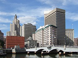
Downtown is the central economic, political, and cultural district of the city of Providence, Rhode Island, United States. It is bounded on the east by Canal Street and the Providence River, to the north by Smith Street, to the west by Interstate 95, and to the south by Henderson Street. The highway serves as a physical barrier between the city's commercial core and neighborhoods of Federal Hill, West End, and Upper South Providence. Most of the downtown is listed on the National Register of Historic Places as the Downtown Providence Historic District.
- ^ "National Register Information System". National Register of Historic Places. National Park Service. January 23, 2007.


