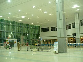
Dr. Babasaheb Ambedkar International Airport | |||||||||||
|---|---|---|---|---|---|---|---|---|---|---|---|
 | |||||||||||
| Summary | |||||||||||
| Airport type | Public | ||||||||||
| Owner | Airports Authority of India | ||||||||||
| Operator | GMR Group & MIHAN India Private Limited (MIPL) | ||||||||||
| Serves | Nagpur | ||||||||||
| Location | Sonegaon, Maharashtra, India | ||||||||||
| Focus city for | |||||||||||
| Elevation AMSL | 315 m / 1,033 ft | ||||||||||
| Coordinates | 21°05′32″N 79°02′50″E / 21.09222°N 79.04722°E | ||||||||||
| Map | |||||||||||
| Runways | |||||||||||
| |||||||||||
| Statistics (April 2023 - March 2024) | |||||||||||
| |||||||||||
Dr. Babasaheb Ambedkar International Airport (IATA: NAG, ICAO: VANP) is an international airport serving the city of Nagpur, Maharashtra, India. The airport is located at Sonegaon, 8 km (5 mi) southwest of Nagpur. The airport covers an area of 1,355 acres (548 hectares). In 2005, it was named after B. R. Ambedkar,[4] the chief architect of the Constitution of India and one of the founding fathers of the Republic of India. The airport handles around 8,500 passengers per day and caters to four domestic airlines and two international airlines connecting Nagpur to Sharjah, Doha, and 14 domestic destinations. The airport spread over 1,460 acres is also home to Nagpur Air Force Station of the Indian Air Force. Growth in passenger traffic is fuelled by passengers traveling to and from the state capital Mumbai, located over 700 km (378 mi) away. The airport has one terminal and has two aerobridges.
- ^ "Annexure III – Passenger Data" (PDF). aai.aero. Retrieved 23 April 2024.
- ^ "Annexure II – Aircraft Movement Data" (PDF). aai.aero. Retrieved 23 April 2024.
- ^ "Annexure IV – Freight Movement Data" (PDF). aai.aero. Retrieved 23 April 2024.
- ^ "Nagpur Airport being renamed". The Hindu. 15 October 2005. Archived from the original on 28 December 2005. Retrieved 3 March 2012.

