| Dragoon Mountains | |
|---|---|
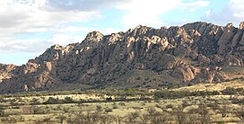
 Dragoon Mountains viewed from the south. | |
| Highest point | |
| Peak | Mount Glenn |
| Elevation | 7,532 ft (2,296 m) |
| Coordinates | 31°53′N 109°59′W / 31.883°N 109.983°W |
| Dimensions | |
| Length | 43 mi (69 km) north to south |
| Width | 35 mi (56 km) east to west Extent includes low land hills and valleys[1] |
| Area | 921 sq mi (2,390 km2) |
| Geography | |
| Country | United States |
| State | Arizona |
| Region | Madrean Sky Islands |
| District | Cochise County |
| Borders on | Little Dragoon Mountains-NW Sulphur Springs Valley-NE San Pedro Valley (Arizona)-W & SW |
The Dragoon Mountains is a range of mountains located in Cochise County, Arizona. The range is about 25 mi (40 km) long, running on an axis extending south-south east through Willcox. The name originates from the 3rd U.S. Cavalry Dragoons who battled the Chiricahua, including Cochise, during the Apache Wars. The Dragoons established posts around 1856 after the Gadsden Purchase made it a U.S. territory.
