Drongen | |
|---|---|
 | |
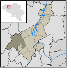
 Location of Drongen in Ghent | |
| Coordinates: 51°3′1″N 3°39′46″E / 51.05028°N 3.66278°E | |
| Country | |
| Community | |
| Region | |
| Province | |
| Arrondissement | Ghent |
| Municipality | Ghent |
| Area | |
| • Total | 27.43 km2 (10.59 sq mi) |
| Population (2020-01-01) | |
| • Total | 13,038 |
| • Density | 480/km2 (1,200/sq mi) |
| Postal codes | 9031 |
| Area codes | 09 |
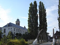
Drongen (Dutch pronunciation: [ˈdrɔŋə(n)] ; French: Tronchiennes, pronounced [tʁɔ̃ʃjɛn]) is a sub-municipality of the city of Ghent located in the province of East Flanders, Flemish Region, Belgium. It was a separate municipality until 1977. In 1967, part of the original municipality was already annexed to Ghent.[1] On 1 January 1977, the municipality of Drongen was merged into Ghent.[2]
Drongen is divided into three parishes: Drongen, Luchteren and Baarle.
- ^ "Desteldonk". Agentschap Onroerend Erfgoed (in Dutch). Retrieved 8 May 2022.
- ^ "LISTE ALPHABETIQUE DES COMMUNES - Fusions de 1963 à 1977" (PDF).


