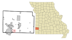
Duenweg, Missouri | |
|---|---|
 Location of Duenweg, Missouri | |
| Coordinates: 37°05′03″N 94°24′43″W / 37.08417°N 94.41194°W | |
| Country | United States |
| State | Missouri |
| County | Jasper |
| Government | |
| • Mayor | Russell Olds |
| Area | |
• Total | 3.08 sq mi (7.96 km2) |
| • Land | 3.05 sq mi (7.89 km2) |
| • Water | 0.03 sq mi (0.07 km2) |
| Elevation | 1,070 ft (330 m) |
| Population (2020) | |
• Total | 1,495 |
| • Density | 490.49/sq mi (189.40/km2) |
| Time zone | UTC-6 (Central (CST)) |
| • Summer (DST) | UTC-5 (CDT) |
| ZIP code | 64841 |
| Area code | 417 |
| FIPS code | 29-20314[3] |
| GNIS feature ID | 2394567[2] |
| Website | duenwegmo |
Duenweg (/dʌnəˈweɪɡ/ dun-ə-WAYG) is a city in Jasper County, Missouri, United States. The population was 1,495 at the 2020 census.[4] It is located within the Township of Joplin, a minor civil division of Jasper County,[5] and is part of the Joplin, Missouri Metropolitan Statistical Area. It is located just to the east of the City of Joplin.[6] Interstate 44 and Interstate 49 run concurrently across the southeast corner of town, and Business Loop 44 runs through the center of town.[6]
- ^ "ArcGIS REST Services Directory". United States Census Bureau. Retrieved August 28, 2022.
- ^ a b U.S. Geological Survey Geographic Names Information System: Duenweg, Missouri
- ^ "U.S. Census website". United States Census Bureau. Retrieved January 31, 2008.
- ^ "Explore Census Data". data.census.gov. Retrieved December 19, 2021.
- ^ "Duenweg, MO Profile: Facts and Data". HomeTownLocator. Retrieved October 30, 2021.
- ^ a b "Duenweg, Missouri". Google Maps. Retrieved October 30, 2021.