| Dunk Island (Coonanglebah) Queensland | |
|---|---|
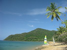
 Mount Kootaloo behind Brammo Bay | |
| Coordinates | 17°56′48″S 146°09′22″E / 17.94667°S 146.15611°E |
| Area | 10 km2 (3.9 sq mi) |
| State electorate(s) | Hill |
| Federal division(s) | Kennedy |

Dunk Island, known as Coonanglebah in the Warrgamay and Dyirbal languages, is an island within the locality of Dunk in the Cassowary Coast Region, Queensland, Australia.[1] It lies 4 kilometres (2.5 mi) off the Australian east coast, opposite the town of Mission Beach. The island forms part of the Family Islands National Park and is in the larger Great Barrier Reef World Heritage Area.[2]
The island is surrounded by reefs and has a diverse population of birds. The Bandjin and Djiru peoples once used the island as a source for food. Europeans first settled on the island in 1897. Dunk Island was used by the Royal Australian Air Force during World War II. In recent years the island and its resort facilities have been adversely affected by both Cyclone Larry and Cyclone Yasi.
- ^ "Dunk Island (entry 10864)". Queensland Place Names. Queensland Government. Retrieved 18 February 2014.
- ^ "About Family Islands". Department of Environment and Resource Management. Archived from the original on 28 July 2012. Retrieved 10 May 2011.
