| Dunsop Bridge | |
|---|---|
 Dunsop Bridge Post Office | |
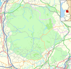
Location within Lancashire | |
| OS grid reference | SD659501 |
| Civil parish | |
| District | |
| Shire county | |
| Region | |
| Country | England |
| Sovereign state | United Kingdom |
| Post town | CLITHEROE |
| Postcode district | BB7 |
| Dialling code | 01200 |
| Police | Lancashire |
| Fire | Lancashire |
| Ambulance | North West |
| UK Parliament | |
Dunsop Bridge is a village in the civil parish of Bowland Forest High, in the borough of Ribble Valley, Lancashire, England, 9 miles (14 km) north-west of Clitheroe, 15 miles (24 km) south-east of Lancaster and 24.5 miles (39 km) west of Skipton. Historically, the village is part of the West Riding of Yorkshire, but was placed under the administration of Lancashire County Council on 1 April 1974.
It is often cited as the geographic centre of Great Britain, although the exact point is at Whitendale Hanging Stones, near Brennand Farm, 4+1⁄2 miles (7 km) north of the village.[1]
In 1992, BT installed its 100,000th payphone at Dunsop Bridge and included a plaque to explain its significance. The telephone box was unveiled by Sir Ranulph Fiennes. In BT's A1141 list of unique alphabetical Telephone Exchange codes, the code for Dunsop Bridge is DSB.
- ^ "Centre of Britain". Archived from the original on 9 November 2013. Retrieved 28 May 2008.


