Durham, Connecticut | |
|---|---|
| Town of Durham | |
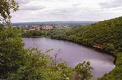
 View from Pistapaug Mountain | |
| Coordinates: 41°27′37″N 72°40′55″W / 41.46028°N 72.68194°W | |
| Country | |
| U.S. state | |
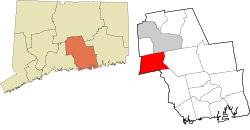
| County | Middlesex |
| Region | Lower CT River Valley |
| Incorporated | 1708 |
| Government | |
| • Type | Selectman-town meeting |
| • First selectman | Brendan Rea (R) |
| • Selectman | Robert Chadd (R) |
| • Selectman | Thomas Hennick (D) |
| Area | |
• Total | 23.8 sq mi (61.6 km2) |
| • Land | 23.6 sq mi (61.1 km2) |
| • Water | 0.2 sq mi (0.4 km2) |
| Elevation | 161 ft (49 m) |
| Population (2020) | |
• Total | 7,152 |
| • Density | 303.1/sq mi (117.0/km2) |
| Time zone | UTC-5 (Eastern) |
| • Summer (DST) | UTC-4 (Eastern) |
| ZIP code | 06422 |
| Area code(s) | 860/959 |
| FIPS code | 09-20810 |
| GNIS feature ID | 0213419[1] |
| Website | www |
Durham (/ˈdɜːrəm/ DURR-əm) is a town in Middlesex County, Connecticut, United States. Durham is a former farming village on the Coginchaug River in central Connecticut. The town is part of the Lower Connecticut River Valley Planning Region. The population was 7,152 at the 2020 census.[2] Every autumn, the town hosts the Durham Fair, the largest volunteer agricultural fair in New England.
The Durham town center is listed by the U.S. Census Bureau as a census-designated place. The core of the town center has also been listed as a historic district on the National Register of Historic Places.


