Dvaleti | |
|---|---|
 Historical map | |
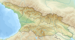
 Map highlighting the historical region of Dvaleti in the borders of modern North Ossetia–Alania. | |
| Coordinates: 42°40′N 44°00′E / 42.667°N 44.000°E | |
| Country | |
| Part of a series on the |
| History of Georgia |
|---|
 |
Dvaleti (Georgian: დვალეთი; also Tvaleti - თვალეთი) was a historical and ethnographic region in medieval Georgia. Territory in the central part of the Greater Caucasus Mountains, between Mamison Pass and Darial Gorge was associated with Dvaleti. According to Vakhusthi Bagrationi territory of Dvaleti included several gorges, namely: Kasris-Kkhevi, Zramaga, Zhghele, Nara Gorge, Zrogo, and Zakha.[1] Some authors also mentioned Trusso Gorge and Magrandvaleti as being part of Dvaleti, while others disagree. Dvaleti was integral part of the Georgian Kingdoms from the 4th to 3rd century BC onward. After the Russian annexation of the Kingdom of Kartli-Kakheti, in 1859 Dvaleti was excluded from the Tiflis Governorate and incorporated into the Terek Oblast.[2] On modern maps historical region Dvaleti can be found in the south of North Ossetia–Alania, Russian Federation.
- ^ Bagrationi, Vakhushti (1745). აღწერა სამეფოსა საქართველოსა [Description of the Kingdom of Georgia] (in Georgian).
- ^ Topchishvili, Roland (2002). ქართველთა ეთნიკური ისტორია და საქართველოს ისტორიულ-ეთნოგრაფიული მხარეები [Ethnic history of Georgians and historical-geographic regions of Georgia] (in Georgian). Tbilisi: Language and Culture.

