45°00′N 85°00′E / 45.000°N 85.000°E
| Dzungaria | |||||||||||
|---|---|---|---|---|---|---|---|---|---|---|---|
 Dzungaria (Junggar Basin) | |||||||||||
| Chinese name | |||||||||||
| Simplified Chinese | 准噶尔 | ||||||||||
| Traditional Chinese | 準噶爾 | ||||||||||
| |||||||||||
| Beijiang | |||||||||||
| Chinese | 北疆 | ||||||||||
| Literal meaning | Northern Xinjiang | ||||||||||
| |||||||||||
| Mongolian name | |||||||||||
| Mongolian Cyrillic | Зүүнгар нутаг | ||||||||||
| Uyghur name | |||||||||||
| Uyghur | جوڭغار | ||||||||||
| |||||||||||
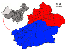
Dzungaria[a] (/(d)zʊŋˈɡɛəriə/; from the Mongolian words züün gar, meaning 'left hand'), also known as Northern Xinjiang or Beijiang,[1] is a geographical subregion in Northwest China that corresponds to the northern half of Xinjiang. Bound by the Altai Mountains to the north and the Tian Shan mountain range to the south, Dzungaria covers approximately 777,000 km2 (300,000 sq mi), and borders Kazakhstan to the west and Mongolia to the east. In contexts prior to the mid-18th century Dzungar genocide, the term "Dzungaria" could cover a wider area, coterminous with the Oirat-led Dzungar Khanate.
Although Dzungaria is geographically, historically, and ethnically distinct from the Tarim Basin or Southern Xinjiang (Nanjiang), the Manchu-led Qing dynasty integrated both areas into one province, Xinjiang. Dzungaria is Xinjiang's center of heavy industry, generates most of the region's GDP, and houses its political capital Ürümqi (Oirat for 'beautiful pasture'). As such, Dzungaria continues to attract intraprovincial and interprovincial migration to its cities. In contrast to the Tarim Basin, Dzungaria is relatively well integrated with the rest of China by rail and trade links.[2]
Cite error: There are <ref group=lower-alpha> tags or {{efn}} templates on this page, but the references will not show without a {{reflist|group=lower-alpha}} template or {{notelist}} template (see the help page).
- ^ S. Frederick Starr (15 March 2004). Xinjiang: China's Muslim Borderland. M.E. Sharpe. pp. 30–. ISBN 978-0-7656-3192-3.
- ^ Stahle, Laura N (August 2009). "Ethnic Resistance and State Environmental Policy: Uyghurs and Mongols" (PDF). University of southern California.[permanent dead link]