| Eagle Creek | |
|---|---|
 North Saskatchewan River drainage basin | |
| Location | |
| Country | |
| Provinces | |
| Physical characteristics | |
| Source | Eaglehill Lake |
| • location | RM of Tramping Lake No. 380 |
| • coordinates | 52°21′01″N 108°56′05″W / 52.3502°N 108.9348°W |
| • elevation | 635 m (2,083 ft) |
| Mouth | North Saskatchewan River |
• location | RM of Eagle Creek No. 376 |
• coordinates | 52°20′47″N 107°24′21″W / 52.3465°N 107.4059°W |
• elevation | 443 m (1,453 ft) |
| Length | 189 km (117 mi) |
| Discharge | |
| • average | 1 m3 (35 cu ft) /second |
| • maximum | 2 m3 (71 cu ft) /second |
| Basin features | |
| River system | North Saskatchewan River |
| Tributaries | |
| • left | Dry Creek |
| • right | Coal Mine Creek |
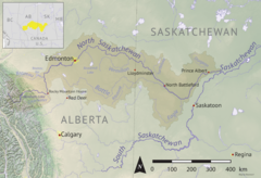
Eagle Creek[1] is a river in the Canadian province of Saskatchewan. The watershed of Eagle Creek is within the semi-arid Palliser's Triangle and is the major drainage system in mid-western Saskatchewan between the South and North Saskatchewan Rivers. Eagle Creek begins at the eastern end of Eaglehill Lake and travels through a glacier-cut valley in the moist, mixed grasslands ecozone of Canada[2] en route to the North Saskatchewan River. The North Saskatchewan River merges with the South Saskatchewan River farther downstream to become the Saskatchewan River.[3]
There are three communities, one regional park, and several highways along the river's course. The communities include Stranraer, Herschel, and Anglia. Highways 51, 31, 4, and 14 are significant highways that cross the river.
- ^ "Eagle Creek". Canadian Geographical Names Database. Government of Canada. Retrieved 17 December 2022.
- ^ "Ecoregions of Saskatchewan". Biolwww. University of Saskatchewan. Retrieved 17 December 2022.
- ^ "Eagle Creek". Angler's Atlas. Angler's Atlas. Retrieved 17 December 2022.

