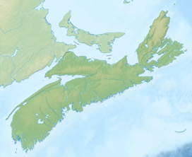
| East Bay Hills | |
|---|---|
East Bay Hills in Nova Scotia | |
| Highest point | |
| Peak | Sgurra Bhreac |
| Elevation | 222 m (728 ft)[1] |
| Prominence | 212 m (696 ft)[2] |
| Parent peak | Blueberry Barren |
| Isolation | 14.92 km (9.27 mi)[2] |
| Coordinates | 45°55′42.88972″N 60°25′46.70739″W / 45.9285804778°N 60.4296409417°W |
| Dimensions | |
| Length | 48 km (30 mi) NE -SW |
| Width | 7.5 km (4.7 mi) NW - SE |
| Naming | |
| Etymology | from the East Bay of the Bras d'Or Lake they border along their northern edge |
| Geography | |
| Location | Cape Breton County, Nova Scotia, Canada |
| Range coordinates | 45°49′50″N 60°36′35″W / 45.83056°N 60.60972°W |
| Parent range | Cape Breton Highlands, Appalachian Mountains |
| Topo map | NTS 11F16 Mira River |
| Geology | |
| Age of rock | Precambrian |
| Mountain type | Fault-block mountains |
| Climbing | |
| Access | road/hike |
The East Bay Hills[3][4] refer to a 'fault ridge' of ancient rock on the south side of the East Bay of the Bras d'Or Lake, located on Cape Breton Island, Canada, and are an extension of the Appalachian mountain chain. The East Bay Hills lie in Cape Breton County.
The East Bay Hills rise to little more than 180 metres (590 ft), forming low ridges in an otherwise lowland landscape. These hill are largely uninhabited (by humans), and include the highest elevation point on Cape Breton Island south of the Bras d'Or Lake at Sgurra Bhreac with a commanding view of the Mira area and Atlantic Ocean to the south.
- ^ The Nova Scotia Atlas: Province of Nova Scotia. Government of Nova Scotia. 16 June 2006. p. 24, V2. ISBN 9780887807077. Retrieved 18 June 2018.
- ^ a b "Sgurra Bhreac, Nova Scotia". Peakbagger.com. Retrieved 9 April 2012.
- ^ Geographical Names of Canada - East Bay Hills
- ^ "Nova Scotia Geographical Names Database entry for "East Bay Hills, County of Cape Breton" (includes map)". Government of Nova Scotia. Retrieved 9 May 2020.

