East Brookfield, Massachusetts | |
|---|---|
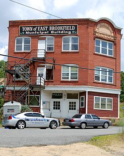
 The Keith Block, formerly the East Brookfield Municipal Building | |
 Location in Worcester County and the state of Massachusetts. | |
| Coordinates: 42°13′40″N 72°02′50″W / 42.22778°N 72.04722°W | |
| Country | United States |
| State | Massachusetts |
| County | Worcester |
| Settled | 1664 |
| Incorporated | 1920 |
| Government | |
| • Type | Open town meeting |
| • Town Secretary | Deborah A. Morgan |
| Area | |
• Total | 10.4 sq mi (26.9 km2) |
| • Land | 9.8 sq mi (25.5 km2) |
| • Water | 0.5 sq mi (1.4 km2) |
| Elevation | 620 ft (189 m) |
| Population (2020) | |
• Total | 2,224 |
| • Density | 210/sq mi (83/km2) |
| Time zone | UTC-5 (Eastern) |
| • Summer (DST) | UTC-4 (Eastern) |
| ZIP code | 01515 |
| Area code | 508 / 774 |
| FIPS code | 25-18560 |
| GNIS feature ID | 0618362 |
| Website | www.eastbrookfieldma.us |
East Brookfield is a town in Worcester County, Massachusetts, United States. The population was 2,224 at the 2020 United States Census.[1] The census-designated place of East Brookfield (CDP) is located in the town.
- ^ "Census - Geography Profile: East Brookfield town, Worcester County, Massachusetts". Retrieved November 12, 2021.

