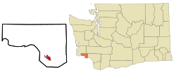
East Cathlamet, Washington | |
|---|---|
 Location of East Cathlamet, Washington | |
| Coordinates: 46°11′48″N 123°21′29″W / 46.19667°N 123.35806°W | |
| Country | United States |
| State | Washington |
| County | Wahkiakum |
| Area | |
• Total | 1.713 sq mi (4.436 km2) |
| • Land | 1.713 sq mi (4.436 km2) |
| • Water | 0.000 sq mi (0.000 km2) 0.00% |
| Elevation | 400 ft (122 m) |
| Population (2020) | |
• Total | 578 |
| • Density | 340/sq mi (130/km2) |
| Time zone | UTC−8 (PST) |
| • Summer (DST) | UTC−7 (PDT) |
| ZIP code | 98612 |
| Area code | 360 |
| FIPS code | 53-19290 |
| GNIS feature ID | 2408703 |
East Cathlamet is a census-designated place (CDP) in Wahkiakum County, Washington, on the eastern border of the town of Cathlamet. The population was 578 as of the 2020 census. The East Cathlamet community is part of the Wahkiakum School District, a K-12 school district of about 430 students. The name "Kathlamet" (Cathlamet) comes from the Kathlamet tribe, which in their language, means "rocky shore."[3]
- ^ "2013 U.S. Gazetteer Files". census.gov. Retrieved June 20, 2014.
- ^ "USGS—East Cathlamet, Washington". Retrieved June 20, 2014.
- ^ "Cathlamet – Thumbnail History". historylink.org. February 3, 2009. Retrieved June 20, 2014.