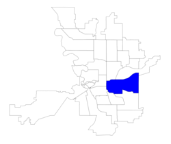
East Central | |
|---|---|
 Sprague Union District | |
 Location within the city of Spokane | |
| Coordinates: 47°39′29.5″N 117°22′22.5″W / 47.658194°N 117.372917°W | |
| Country | United States |
| State | Washington |
| County | Spokane |
| City | Spokane |
| Population (2017[1]) | |
| • Total | 12,126 |
| Demographics 2017 | |
| • White | 76.7% |
| • Black | 6.3% |
| • Latinx | 7.5% |
| • Asian | 5.0% |
| • Native American | 2.6% |
| Time zone | UTC-8 (PST) |
| • Summer (DST) | UTC-7 (PDT) |
| ZIP Codes | 99202 |
| Area code | 509 |
East Central is a neighborhood in Spokane, Washington. As the name suggests, it is on the east side of Spokane and centrally located. The official neighborhood is expansive and covers multiple areas considered by locals to be independent neighborhoods, such as the Sprague Union District on East Sprague Avenue,[2] the South Perry District,[3] the Underhill Park area[4] and the University District on the eastern fringe of Downtown Spokane.[5]
- ^ "East Central Neighborhood Snapshot" (PDF). spokanecity.org. City of Spokane. Retrieved 29 October 2021.
- ^ "About the Sprague Union District". spragueuniondistrict.com. Retrieved 24 May 2022.
- ^ "South Perry District". visitspokane.com. Visit Spokane.
- ^ Bower, Esther (8 October 2021). "Packed In: 'In the name of the almighty dollar': Homeowners say development's destroying East Central". KXLY. KXLY. Retrieved 29 October 2021.
- ^ "Map | The University District". spokaneudistrict.org. The University District. Retrieved 29 October 2021.