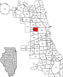
East Garfield Park | |
|---|---|
| Community Area 27 - East Garfield Park | |
 The Garfield Park fieldhouse | |
 Location within the city of Chicago | |
| Coordinates: 41°52.8′N 87°42′W / 41.8800°N 87.700°W | |
| Country | United States |
| State | Illinois |
| County | Cook |
| City | Chicago |
| Neighborhoods | |
| Area | |
| • Total | 1.94 sq mi (5.02 km2) |
| Population (2020) | |
| • Total | 19,992[1] |
| Demographics 2020[1] | |
| • White | 5.9% |
| • Black | 84.9% |
| • Hispanic | 4.8% |
| • Asian | 0.9% |
| • Other | 3.5% |
| Educational Attainment 2020[1] | |
| • High School Diploma or Higher | 79.2% |
| • Bachelor's Degree or Higher | 18.8% |
| Time zone | UTC-6 (CST) |
| • Summer (DST) | UTC-5 (CDT) |
| ZIP Codes | parts of 60612 and 60624 |
| Median household income (2020)[1] | $23,067 |
| Source: U.S. Census, Record Information Services | |
East Garfield Park is a neighborhood on the West Side of Chicago, Illinois, west of the Loop.
Taking its name from the large urban park, Garfield Park, the neighborhood is bordered by the Union Pacific railroad tracks on the north, Arthington and Taylor Streets on the south, Hamlin Avenue and Independence Boulevard to the west, and Rockwell Street to the east.
- ^ a b c d "Community Data Snapshot - East Garfield Park" (PDF). cmap.illinois.gov. MetroPulse. Retrieved February 28, 2023.