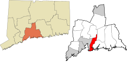
East Haven, Connecticut | |
|---|---|
| Town of East Haven | |
 View of East Haven across the Quinnipiac River | |
| Coordinates: 41°17′44″N 72°51′45″W / 41.29556°N 72.86250°W | |
| Country | |
| U.S. state | |
| County | New Haven |
| Region | South Central CT |
| Incorporated | 1785 |
| Government | |
| • Type | Mayor-council |
| • Mayor | Joseph Carfora |
| Area | |
• Total | 13.4 sq mi (34.8 km2) |
| • Land | 12.3 sq mi (31.8 km2) |
| • Water | 1.1 sq mi (3.0 km2) |
| Elevation | 30 ft (9 m) |
| Population (2020) | |
• Total | 27,923 |
| • Density | 2,100/sq mi (800/km2) |
| Time zone | UTC−5 (Eastern) |
| • Summer (DST) | UTC−4 (Eastern) |
| ZIP code | 06473, 06512, 06513 |
| Area code(s) | 203/475 |
| FIPS code | 09-22910 |
| GNIS feature ID | 0213425 |
| Interstates | |
| U.S. Highways | |
| State Routes | |
| Website | www |
East Haven is a town in New Haven County, Connecticut, in the United States. As of the 2020 census, the town population was 27,923.[1] The town is located 3 miles (5 km) east of New Haven, and is part of the South Central Connecticut Planning Region. East Haven is 35 miles (56 km) from Hartford, 82 miles (132 km) from New York City, 99 miles (159 km) from Providence, Rhode Island, and 140 miles (230 km) from Boston.
- ^ "Census - Geography Profile: East Haven town, New Haven County, Connecticut". United States Census Bureau. Retrieved December 15, 2021.


