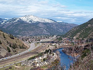
East Missoula, Montana | |
|---|---|
 East Missoula, Montana | |
 Location in Missoula County and the state of Montana | |
| Coordinates: 46°52′30″N 113°56′29″W / 46.87500°N 113.94139°W | |
| Country | United States |
| State | Montana |
| County | Missoula |
| Area | |
• Total | 1.25 sq mi (3.23 km2) |
| • Land | 1.21 sq mi (3.12 km2) |
| • Water | 0.04 sq mi (0.11 km2) |
| Elevation | 3,264 ft (995 m) |
| Population | |
• Total | 2,465 |
| Time zone | UTC-7 (Mountain (MST)) |
| • Summer (DST) | UTC-6 (MDT) |
| ZIP code | 59802 (Missoula) |
| Area code | 406 |
| FIPS code | 30-23200 |
| GNIS feature ID | 0782938 |
East Missoula is an unincorporated community and census-designated place (CDP) in Missoula County, Montana, United States. It is part of the Missoula metropolitan area. The population was 2,465 at the 2020 census,[2] up from 2,157 in 2010.
- ^ "2023 U.S. Gazetteer Files: Montana". United States Census Bureau. Retrieved May 31, 2024.
- ^ a b "P1. Race – East Missoula CDP, Montana: 2020 DEC Redistricting Data (PL 94-171)". U.S. Census Bureau. Retrieved May 31, 2024.