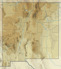
| East Potrillo Mountains | |
|---|---|
 Kilbourne and Hunts Holes and East Potrillo Mountains | |
| Highest point | |
| Peak | Unnamed point on ridge |
| Elevation | 5,344 ft (1,629 m) |
| Coordinates | 31°53.6220′N 107°1.4697′W / 31.8937000°N 107.0244950°W |
| Dimensions | |
| Length | 10 mi (16 km) NNW-SSE |
| Width | 1–2 mi (1.6–3.2 km) WSW-ENE |
| Geography | |
East Potrillo Mountains in New Mexico | |
| Country | United States |
| State | New Mexico |
| County | Doña Ana |
| Range coordinates | 31°52′36″N 107°0′43″W / 31.87667°N 107.01194°W |
| Borders on | West Potrillo Mountains-W Rio Grande Valley (New Mexico)-E Cox Peak, Mt. Riley, Potrillo volcanic field-N |
| Geology | |
| Rock type(s) | Uplifted fault block, with Cretaceous limestone and siltstones overlaying Permian limestones |
The East Potrillo Mountains are a mountain range in south central Doña Ana County, New Mexico. They are located approximately 25 miles (40 km) west of El Paso, Texas, 30 miles (48 km) southwest of Las Cruces, New Mexico, and 30 miles east of Columbus, New Mexico. The southern tip of the range is less than 5 miles (8.0 km) from the Mexican border. The mountains and most of the surrounding acreage are located on land owned by the Bureau of Land Management. Access to the general vicinity is through New Mexico State Road 9, and several unpaved county roads.
