| East Siberian Mountains | |
|---|---|
| Восточно-Сибирское нагорье | |
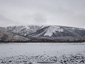
 View of the northern end of the Chersky Range | |
| Highest point | |
| Peak | Pobeda |
| Elevation | 3,003 m (9,852 ft) |
| Coordinates | 65°10′38″N 146°00′35″E / 65.17722°N 146.00972°E |
| Dimensions | |
| Length | 2,700 km (1,700 mi) |
| Width | 1,200 km (750 mi) |
| Area | 2,000,000 square kilometres (770,000 sq mi) |
| Geography | |
| Country | Russia |
| Federal subjects | Sakha Republic, Magadan Oblast, Chukotka Autonomous Okrug, Kamchatka Krai and Khabarovsk Krai |
| Range coordinates | 65°N 158°E / 65°N 158°E |
| Borders on | Central Yakutian Lowland, East Siberian Lowland and South Siberian Mountains |
| Geology | |
| Orogeny | Alpine orogeny |
| Climbing | |
| Easiest route | From Yakutsk or Magadan |
The East Siberian Mountains or East Siberian Highlands (Russian: Восточно-Сибирское нагорье, romanized: Vostochno-Sibirskoye Nagorye) are one of the largest mountain systems of the Russian Federation. They are located between the Central Yakutian Lowland and the Bering Strait in Northeast Siberia. The area of the East Siberian Mountains has a very low population density.[1] The territory of the mountain system is one of the Great Russian Regions.
In some areas of the East Siberian Mountains, such as the Kisilyakh Range and the Oymyakon Plateau there are kigilyakhs, the rock formations that are highly valued in the culture of the Yakuts.[2]
- ^ Gvozdetsky N. A. & Mikhailov N. I. Physical geography of the USSR. M., Thought, 1978. OCLC 17901203
- ^ "Кисиляхи" (in Russian).
