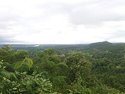
East Singhbhum district
| |
|---|---|
Clockwise from top-left: Sakchi Market, Jayanti Sarovar in Jubilee Park, Subarnarekha near Ratmohana, Siddheshwar Hill, Rankini Mandir, Jadugora | |
 Location of East Singhbhum district in Jharkhand | |
| Country | |
| State | |
| Division | Kolhan |
| Established | 16 January 1990 |
| Headquarter | Jamshedpur |
| Government | |
| • Lok Sabha constituencies | Jamshedpur |
| • Vidhan Sabha constituencies | 6 |
| Area | |
| • Total | 3,562 km2 (1,375 sq mi) |
| • Urban | 187 km2 (72 sq mi) |
| • Rural | 3,374 km2 (1,303 sq mi) |
| Population (2011) | |
| • Total | 2,293,919 |
| • Density | 640/km2 (1,700/sq mi) |
| • Urban | 1,274,591 |
| • Urban density | 6,800/km2 (18,000/sq mi) |
| • Rural | 1,019,328 |
| • Rural density | 300/km2 (780/sq mi) |
| • Scheduled Castes | 111,414 (4.86%) |
| • Scheduled Tribes | 653,923 (28.51%) |
| Demographics | |
| • Literacy | 75.49 per cent |
| • Sex ratio | 949 |
| Time zone | UTC+05:30 (IST) |
| Vehicle registration | JH-05 |
| Major highways | NH 18, NH 118, NH 220, NH 49 |
| Website | jamshedpur |
East Singhbhum is one of the 24 districts of Jharkhand, India. It was created on 16 January 1990. More than 50% of the district is covered by dense forests and mountains, where wild animals once roamed freely. It is known for being a centre of industry since Jamshedpur, the most populous city in Jharkhand, is located here.


