Eastern Passage | |
|---|---|
Community | |
 The town centre of Eastern Passage (1 July 2016) | |
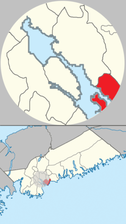
 Cow Bay & Eastern Passage planning area of municipal Halifax. | |
| Coordinates: 44°36′42″N 63°29′39″W / 44.611656°N 63.494098°W | |
| Country | |
| Province | |
| Municipality | Halifax Regional Municipality |
| District | 3 - Dartmouth South - Eastern Passage |
| Founded | circa 1798 |
| Government | |
| • Type | Regional Council |
| • Governing Council | Halifax Regional Council |
| • Community Council | Harbour East - Marine Drive Community Council |
| Area | |
| • Total | 13.72 km2 (5.30 sq mi) |
| Elevation | 0−36 m (−118 ft) |
| Population | |
| • Total | 11,738 |
| • Density | 855/km2 (2,210/sq mi) |
| Time zone | UTC-4 (AST) |
| • Summer (DST) | UTC-3 (ADT) |
| Canadian Postal code | B3G |
| Area code | 902 |
| GNBC Code | CAKQU |
| Website | easternpassage.ca |
| Places in Nova Scotia | |
Eastern Passage is an unincorporated suburban community in Halifax Regional Municipality Nova Scotia, Canada.
Eastern Passage has historically been tied to the fishing industry. Its waterfront has several small wharves and piers. The construction of CFB Shearwater, a military air base, at the northern boundary of the community during World War I, and the construction of the Imperial Oil (later Esso), Texaco (later Ultramar) oil refineries, the Volvo Halifax Assembly plant and automobile import/export facility following World War II redefined the local economy. New highway connections have resulted in the majority of area residents commuting to Downtown Halifax or Dartmouth.
- ^ "Halifax Regional Municipality Urban Forest Master Plan" (PDF). halifax.ca. Government of the Municipality of Halifax. Retrieved 4 February 2021.
- ^ "COMMUNITY PROFILE FOR JANUARY: EASTERN PASSAGE". novascotia.ca. Government of Nova Scotia. 2 January 2015. Retrieved 31 October 2022.