Easternijtsjerk | |
|---|---|
Village | |
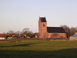
 St Cecile's church | |
 Location in the former Dongeradeel municipality | |
| Coordinates: 53°22′43″N 6°3′13″E / 53.37861°N 6.05361°E | |
| Country | |
| Province | |
| Municipality | Noardeast-Fryslân |
| Area | |
| • Total | 6.68 km2 (2.58 sq mi) |
| Elevation | 0.5 m (1.6 ft) |
| Population (2021)[1] | |
| • Total | 940 |
| • Density | 140/km2 (360/sq mi) |
| Postal code | 9137[1] |
| Dialing code | 0519 |
Easternijtsjerk (Dutch: Oosternijkerk) is a village in Noardeast-Fryslân in the province of Friesland, Netherlands. It had a population of around 944 in January 2017.[3] Before 2019, the village was part of the Dongeradeel municipality.[4]
- ^ a b c "Kerncijfers wijken en buurten 2021". Central Bureau of Statistics. Retrieved 1 April 2022.
two entries
- ^ "Postcodetool for 9137CD". Actueel Hoogtebestand Nederland (in Dutch). Het Waterschapshuis. Retrieved 1 April 2022.
- ^ Aantal inwoners per woonplaats in Dongeradeel op 1 januari 2017 Archived 2017-10-21 at the Wayback Machine - Dongeradeel
- ^ Cite error: The named reference
plaatswas invoked but never defined (see the help page).


