Eaton County | |
|---|---|
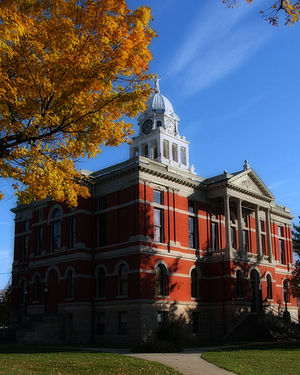
 Eaton County Courthouse | |
 Location within the U.S. state of Michigan | |
 Michigan's location within the U.S. | |
| Coordinates: 42°35′N 84°51′W / 42.59°N 84.85°W | |
| Country | |
| State | |
| Founded | 1837[1] |
| Named for | John Eaton |
| Seat | Charlotte |
| Largest city | Charlotte |
| Area | |
• Total | 579 sq mi (1,500 km2) |
| • Land | 575 sq mi (1,490 km2) |
| • Water | 4.3 sq mi (11 km2) 0.7% |
| Population (2020) | |
• Total | 109,175 |
• Estimate (2023) | 108,820 |
| • Density | 190/sq mi (73/km2) |
| Time zone | UTC−5 (Eastern) |
| • Summer (DST) | UTC−4 (EDT) |
| Congressional districts | 2nd, 7th |
| Website | www |
Eaton County is a county in the U.S. state of Michigan. As of the 2020 United States Census, the population was 109,175.[2] The county seat is Charlotte.[3] The county was organized in 1837 and was named for John Eaton, who was Secretary of War under U.S. President Andrew Jackson, making it one of Michigan's Cabinet counties.[1] Eaton County is included in the Lansing-East Lansing, Metropolitan Statistical area in Central Michigan.
- ^ a b "Bibliography on Eaton County". Clarke Historical Library, Central Michigan University. Retrieved January 19, 2013.
- ^ "State & County QuickFacts". US Census Bureau. Retrieved September 15, 2021.
- ^ "Find a County". National Association of Counties. Archived from the original on July 4, 2012. Retrieved June 7, 2011.
