Eatonville | |
|---|---|
Neighbourhood | |
 Aerial view of North on the West Mall | |
 Vicinity | |
| Coordinates: 43°38′20″N 79°32′52″W / 43.63889°N 79.54778°W | |
| Country | |
| Province | |
| City | Toronto |
| Established | 1918 |
| Changed Municipality | 1998 Toronto from Etobicoke |
| Government | |
| • MP | James Maloney (Etobicoke—Lakeshore) |
| • MPP | Christine Hogarth (Etobicoke—Lakeshore) |
| • Councillor | Stephen Holyday (Ward 2 Etobicoke Centre) |
| • Councillor | Mark Grimes (Ward 3 Etobicoke—Lakeshore) |
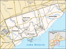
Eatonville is a neighbourhood in Toronto, Ontario, Canada. It is located west of the central core, in the former suburb of Etobicoke. Eatonville is bisected by Highway 427, with the community generally located north of Dundas Street West and south of Rathburn Road. Eatonville consists mainly of low density residential homes (constructed primarily in the 1950s east of Highway 427, and in the 1960s and 1970s west of Highway 427). The main arterial roads in the community, such as The West Mall, The East Mall and Burnhamthorpe Road, contain a mix of rental and condominium high-rise apartments and townhouses. Cloverdale Mall is in the neighbourhood, and there are community retail areas along Bloor Street West and Dundas Street West.
