| Edenfield | |
|---|---|
 A view over Edenfield towards Scout Moor | |
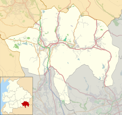
Location within Lancashire | |
| Population | 2,053 (2011 Census) |
| OS grid reference | SD795185 |
| • London | 175.2 miles (282.6 km) SSE |
| District | |
| Shire county | |
| Region | |
| Country | England |
| Sovereign state | United Kingdom |
| Post town | BURY |
| Postcode district | BL0 |
| Dialling code | 01706 |
| Police | Lancashire |
| Fire | Lancashire |
| Ambulance | North West |
| UK Parliament | |
Edenfield is a village within the Rossendale borough of Lancashire, England. Lying on the River Irwell, it is around 1.25 miles (2.0 km) north of Ramsbottom, 2.5 miles (4.0 km) south of Rawtenstall, and 6.0 miles (9.7 km) west of Norden, and has a total population of 2,080,[1] reducing to 2,053 at the 2011 Census.[2]
Edenfield village centre lies at the intersection of three A roads; the A676 from Bolton, the A680 from Accrington and Rochdale and the A56 from Rawtenstall and Bury. The M66 motorway terminates its course at Edenfield, whereupon it becomes the A56 dual carriageway known as the Edenfield Bypass.
The village has recently seen growth as a commuter settlement for Greater Manchester.
- ^ Lancashire County Council. "Population of Lancashire Urban Areas 2001". Archived from the original on 8 August 2007. Retrieved 12 June 2007.
- ^ "Village population 2011". Retrieved 14 January 2016.

