Eide Municipality
Eide herred | |
|---|---|
 View of Eide Church | |
 Aust-Agder within Norway | |
 Eide within Aust-Agder | |
| Coordinates: 58°16′11″N 08°28′41″E / 58.26972°N 8.47806°E | |
| Country | Norway |
| County | Aust-Agder |
| District | Østre Agder |
| Established | 1 Jan 1838 |
| • Created as | Formannskapsdistrikt |
| Disestablished | 1 Jan 1964 |
| • Succeeded by | Landvik Municipality |
| Administrative centre | Eide |
| Area (upon dissolution)[1] | |
| • Total | 32.4 km2 (12.5 sq mi) |
| Population (1962) | |
| • Total | 504 |
| • Density | 16/km2 (40/sq mi) |
| Demonym | Eidesokning[2] |
| Time zone | UTC+01:00 (CET) |
| • Summer (DST) | UTC+02:00 (CEST) |
| ISO 3166 code | NO-0925[3] |
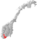
Eide is a former municipality in the old Aust-Agder county in Norway. It is currently located within the municipality of Grimstad in Agder county. The municipality of Eide existed from 1838 until 1962. The 32.4-square-kilometre (12.5 sq mi) municipality included 29.2 square kilometres (11.3 sq mi) of land on the mainland and the rest being nearly 70 small islands off the Skaggerak coast. The larger islands include Auseøya, Homborøya, and Ålesøya.[1] The administrative centre was the village of Eide where the Eide Church is located. Other villages in Eide included Jortveit and Homborsund.
- ^ a b Cite error: The named reference
NLFwas invoked but never defined (see the help page). - ^ "Navn på steder og personer: Innbyggjarnamn" (in Norwegian). Språkrådet.
- ^ Bolstad, Erik; Thorsnæs, Geir, eds. (26 January 2023). "Kommunenummer". Store norske leksikon (in Norwegian). Kunnskapsforlaget.