Eijsden-Margraten | |
|---|---|
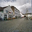
View on Neerbeek View on Margraten Blankenberg Castle at Cadier en Keer Gronsveld castle | |
 Location in Limburg | |
| Coordinates: 50°47′N 5°42′E / 50.783°N 5.700°E | |
| Country | Netherlands |
| Province | Limburg |
| Established | 1 January 2011[1] |
| Government | |
| • Body | Municipal council |
| • Mayor | Sjraar Cox |
| Area | |
| • Total | 78.77 km2 (30.41 sq mi) |
| • Land | 77.55 km2 (29.94 sq mi) |
| • Water | 1.22 km2 (0.47 sq mi) |
| Elevation | 56 m (184 ft) |
| Population (January 2021)[5] | |
| • Total | 25,900 |
| • Density | 334/km2 (870/sq mi) |
| Time zone | UTC+1 (CET) |
| • Summer (DST) | UTC+2 (CEST) |
| Postcode | 6245–6269, 6307 |
| Area code | 043 |
| Website | www |
Eijsden-Margraten (Dutch pronunciation: [ˌɛizdəˈmɑrɣraːtə(n)]; (Limburgish: Èèsjde-Mergraote) is a municipality situated in the very south of the Netherlands. There it is located in the southeastern part of the province of Limburg.
This municipality was formed in 2011 from the former municipalities of Eijsden and Margraten, that both consisted of a number of separately situated villages. As a result, the nowadays Eijsden-Margraten municipality consists of 28 villages and townships, spread out over 15 administrative centres. As of 2011, it has a population of about 25,000.
Eijsden-Margraten is one of the most southerly municipalities in the Netherlands, for in its south it is extending up to the most southerly part of the border between the Netherlands and Belgium.
The Meuse river, coming from France and Belgium, at Eijsden enters its third and final flowing country, the Netherlands. From here on its name in Dutch is "Maas". Running northward to Eijsden-Margraten's west it locally forms the westerly frontier of the last mentioned country with Belgium.
A smaller stream, the Voer, coming from Belgium, drains into the Meuse river in this municipality, after having passed through a few of its villages.
- ^ "Gemeentelijke indeling op 1 januari 2011" [Municipal divisions on 1 January 2011]. cbs.nl (in Dutch). CBS. Retrieved 30 July 2013.
- ^ "College van B&W" [Council of mayor and aldermen] (in Dutch). Gemeente Eijsden-Margraten. Archived from the original on 7 August 2013. Retrieved 30 July 2013.
- ^ "Kerncijfers wijken en buurten 2020" [Key figures for neighbourhoods 2020]. StatLine (in Dutch). CBS. 24 July 2020. Retrieved 19 September 2020.
- ^ "Postcodetool for 6245EH". Actueel Hoogtebestand Nederland (in Dutch). Het Waterschapshuis. Retrieved 30 July 2013.
- ^ "Bevolkingsontwikkeling; regio per maand" [Population growth; regions per month]. CBS Statline (in Dutch). CBS. 1 January 2021. Retrieved 2 January 2022.


