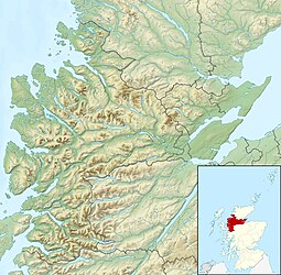
| Scottish Gaelic name | Eilean Donnain |
|---|---|
| Meaning of name | Island of Donnán |
 Eilean Donan Castle | |
| Location | |
| OS grid reference | NG880260 |
| Coordinates | 57°16′26.50″N 05°30′58″W / 57.2740278°N 5.51611°W |
| Physical geography | |
| Island group | Loch Duich |
| Highest elevation | 3 m (10 ft) |
| Administration | |
| Council area | Highland |
| Country | Scotland |
| Sovereign state | United Kingdom |
| Demographics | |
| Population | 0[1] |
Eilean Donan (Scottish Gaelic: Eilean Donnain) is a small tidal island situated at the confluence of three sea lochs (Loch Duich, Loch Long and Loch Alsh) in the western Highlands of Scotland, about 1 kilometre (5⁄8 mi) from the village of Dornie. It is connected to the mainland by a footbridge that was installed early in the 20th century and is dominated by a picturesque castle that frequently appears in photographs, film and television. The island's original castle was built in the thirteenth century; it became a stronghold of the Clan Mackenzie and their allies, the Clan MacRae. In response to the Mackenzies' involvement in the Jacobite rebellions early in the 18th century, government ships destroyed the castle in 1719. The present-day castle is Lieutenant-Colonel John Macrae-Gilstrap's 20th-century reconstruction of the old castle.[2]
Eilean Donan is part of the Kintail National Scenic Area, one of 40 in Scotland.[3] In 2001, the island had a recorded population of just one person,[4] but there were no "usual residents" at the time of the 2011 census.[1]
Eilean Donan, which means simply "island of Donnán", is named after Donnán of Eigg, a Celtic saint who was martyred in 617. Donnán is said to have established a church on the island, though no trace of this remains.[2]
- ^ a b National Records of Scotland (15 August 2013). "Appendix 2: Population and households on Scotland's Inhabited Islands" (PDF). Statistical Bulletin: 2011 Census: First Results on Population and Household Estimates for Scotland Release 1C (Part Two) (PDF) (Report). SG/2013/126. Retrieved 14 August 2020.
- ^ a b Historic Environment Scotland. "Eilean Donan (11837)". Canmore. Retrieved 23 January 2018.
- ^ "National Scenic Areas". Scottish Natural Heritage. Archived from the original on 11 March 2017. Retrieved 22 April 2013.
- ^ General Register Office for Scotland (28 November 2003) Scotland's Census 2001 – Occasional Paper No 10: Statistics for Inhabited Islands. Retrieved 26 February 2012.
