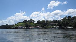
El Castillo | |
|---|---|
 | |
 Location of the municipality of El Castillo within the Río San Juan Department, Nicaragua | |
| Coordinates: 11°02′N 84°28′W / 11.033°N 84.467°W | |
| Country | Nicaragua |
| Department | Río San Juan |
| Municipality | El Castillo |
| Area | |
• Total | 1,656 km2 (639 sq mi) |
| Elevation | 33 m (108 ft) |
| Population (2005)[1] | |
• Total | 19,864 |
El Castillo is a municipality located on the Río San Juan (San Juan River) in the Río San Juan Department of Nicaragua. The settlement of what would eventually become the municipality of El Castillo began in 1673, when construction of the Fortaleza de la Limpia Pura e Inmaculada Concepción, (now known as the Castillo de la Inmaculada Concepción, or Fortress of the Immaculate Conception) was begun. The village of El Castillo eventually grew around the fortress, which continued to be strategically important to the Captaincy General of Guatemala until the late 18th century.
The administrative capital of the municipality of El Castillo is the village of Boca de Sábalos, which translates from Spanish to "mouth of the tarpon" (Megalops atlanticus). Boca de Sábalos is located 350 kilometers from the national capital of Managua, 55 kilometers downriver from the departmental capital of San Carlos and several kilometers upriver from the village of El Castillo.
- ^ Instituto Nacional de Estadísticas y Censos, Nicaragua (2005). "Censo del 2005" (PDF) (in Spanish). Managua: National Institute of Statistics and Census of Nicaragua. Archived from the original (PDF) on 2011-07-23. Retrieved 2011-04-22.