| Monte Toro | |
|---|---|
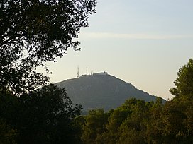
 View of El Toro from the Ben path in August 2006 | |
| Highest point | |
| Elevation | 358 m (1,175 ft) |
| Prominence | 342 m (1,122 ft) |
| Coordinates | 39°59′6″N 4°6′49″E / 39.98500°N 4.11361°E |
| Geography | |
| Location | Menorca, Balearic Islands, Spain |
El Toro in Catalan, sometimes known by its Spanish name of Monte Toro, is the tallest hill of the island of Menorca, rising to an elevation of 358 m (1,175 ft) above mean sea level. The mountain is home to the Sanctuary of the Verge del Toro. The mountain's summit can be reached by car or on foot, from which there is a fantastic view of almost the entire island and even the mountains of Mallorca on a clear day.
El Toro is designated as an ANEI (protected natural area).


